
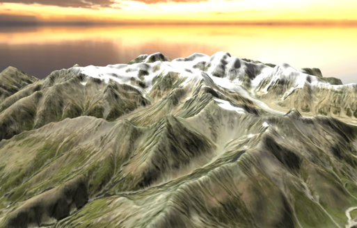
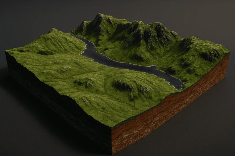
3D Indian map of Himalayas
Create and customize your 3d earth map with this stunning model of the Himalayas.
Create your 3d map of Himalayas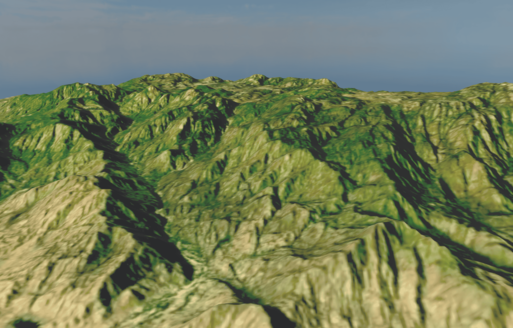
3D India Mountain map of Aravalli Hills
Create and customize your 3d map of india mountains with this stunning model of Aravalli Hills.
Create your 3d map of india mountains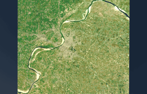
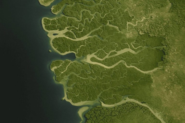
3D Indian River Map of Ganges
Create and customize your 3d map of the indian river with this stunning model of the Ganges River.
Create your 3d map of indian river
3D Map of Bhuntar–Manikaran | India Map 3D Model
Explore the 3D Map of Bhuntar–Manikaran Highway in Kullu Valley with our India map 3D model tool—visualize rivers, gorges & terrain in stunning detail. Generate yours now!
Try it now!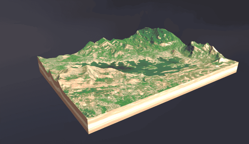
3D Map of Kerala – Interactive 3D Maps & Terrain Viewer
Explore Kerala’s lush backwaters, hill stations, and beaches in stunning detail with our Interactive 3D Map of Kerala—start your immersive 3D mapping journey today!
Try it now!3D Indian map of Himalayas
Create and customize your 3d earth map with this stunning model of the Himalayas.
Create your 3d map of Himalayas3D India Mountain map of Aravalli Hills
Create and customize your 3d map of india mountains with this stunning model of Aravalli Hills.
Create your 3d map of india mountainsWhat Is an Indian Map 3D
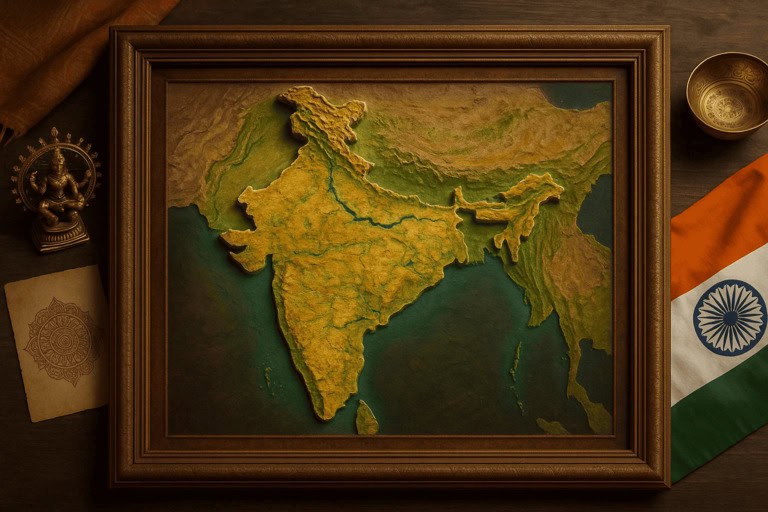
An Indian Map 3D is a three-dimensional digital model of India’s terrain, built from elevation datasets to show mountains, rivers, and plains in true relief. Unlike flat maps, a 3D map reveals topography at a glance—ideal for geographers, educators, and designers.
How to Generate Your 3D Map of India
Step 1: Select Region
Select a region by typing the country name, drawing a rectangle directly on the map, or manually drawing a rectangle to define the area.
Step 2: Adjust Parameters
Adjust height, colors, and details to create the perfect 3d physical map of india.
Step 3: View 3D Maps
Instantly view your India map 3D model in your browser.
Step 4: Download and Share
Save your india map 3d image in PNG, or download and share your 3d map of india in STL, OBJ, GLB, PLY for 3D printing, or online integration
Key Features & Benefits of an Interactive 3D Map of India
High-Resolution Elevation Data
We source NASA’s SRTM 1 arc-second (~30 m) DEM covering all of India to build an accurate triangulated mesh.
Browser-Based Rendering with Mapbox GL JS
Interactive rendering is powered by Mapbox GL JS, enabling smooth pan, zoom, and dynamic lighting in any modern browser—no plugins needed.
Custom Textures & Layers
Overlay satellite imagery or custom textures (e.g., political boundaries, Indian river networks) to produce an India geographical map 3D rich in detail.
Multi-Format Export
Export your Indian Map 3D model in PNG, or STL/OBJ/GLB/PLY for 3D printing and AR applications.
Use Cases of 3D World Map
3D globe map can be embedded on websites for interactive engagement, 3D-printed for unique home décor, used in education to visualize geographical features, and leveraged by brands for marketing and data visualization.
Embed on Your Website
Copy an iframe snippet or use our WordPress plugin to showcase an interactive 3D india geographical map on your site, boosting engagement and visual appeal.
3D Printing & Home Décor
Export an STL to create a 3D map of India—frame it for wall art or design a desk sculpture. Many designers utilize this for personalized home décor.
Education & Research
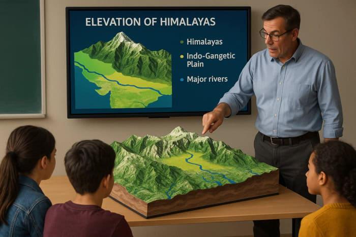
Utilize the 3D relief to teach geography: visualize Himalayan elevation, peninsular plains, and major rivers in immersive 3D—ideal for classrooms and presentations.
Brand & Marketing
Brands embed the 3D map of India to demonstrate regional reach or data visualizations in reports and dashboards.

Explore more 3d maps around the world
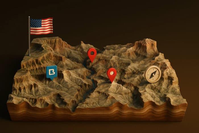
3D Map of USA
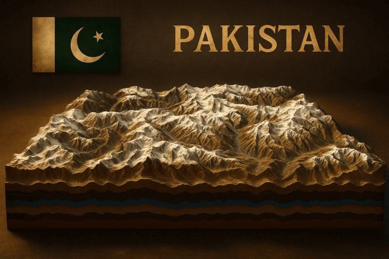
3D Maps of Pakistan
Philippine map 3d
Bangladesh map 3d
3d Map of United Kingdom
Indian 3d map
FAQs
Is the Indian Map 3D free?
Preview and PNG export are free. 3D model exports require a one-time $5 fee or $20 / month subscription.
Which browsers support the tool?
Chrome, Firefox, Safari, and Edge fully supported via WebGL.
How accurate is the elevation?
Based on NASA SRTM 1 arc-second (~30 m) DEM with <16 m vertical accuracy.
How do I embed the 3d map?
Copy the provided share link—zero coding required.